Precision-Driven,
Field-Proven
Eliminate uncertainty with advanced surveying technology. We deliver high-fidelity data and rigorous analysis to power your projects. Minimal margin for error, maximum efficiency for your success.
Rig Positioning &
Navigation
By expertly guiding mobile offshore drilling units to their exact target coordinates, our specialized survey team serves as the primary pilot for the Tug Master and Rig OIM throughout every complex move and rig positioning operation.
Geophysical &
Debris Surveys
Mapping the seabed from the water surface to hundreds of meters below — identifying hazards, infrastructure, and geological conditions before you build, ensuring accurate planning, safer execution, and long-term project reliability and success.
Our Services
and positioning survey capabilities.
Debris Survey
Seabed clearance before jack-up rig emplacement — mapping obstructions within 500m–1,000m radius.
Geophysical Site Survey
Full sub-seabed investigation — geohazards, stratigraphy, and engineering data for foundations.
Rig Positioning
Precision navigation for MODU moves — acting as pilot for the Tug Master and Rig OIM during critical marine operations.
Other Services
USBL positioning, magnetometer surveys, ROV inspection, sediment sampling, and more.
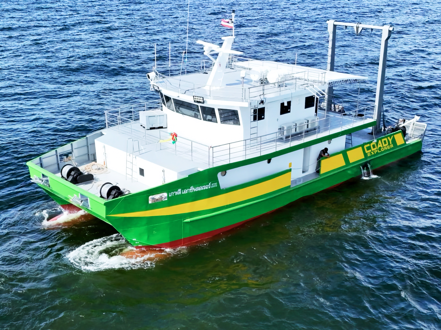
Coady Explorer
Our purpose-built offshore survey vessel, the Coady Explorer is equipped with the full suite of geophysical and hydrographic equipment — ready to mobilize for debris surveys, site surveys, rig positioning, and other offshore operations.
Catamaran
23.8 m
115 GT
2× Diesel
Featured Projects
No posts
News & Activities
No posts
Ready to discuss your next project?
Download our full company profile or get in touch with our team directly.