Geophysical Site Survey
Unveiling the depths beneath the seabed
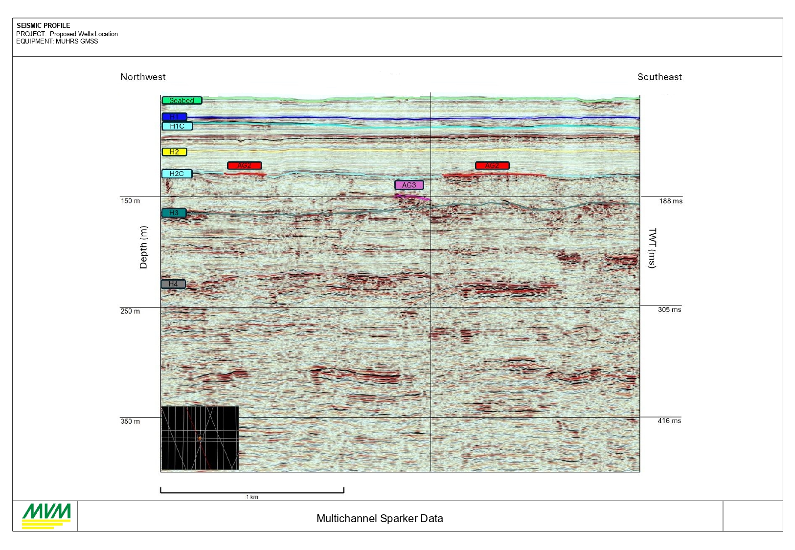
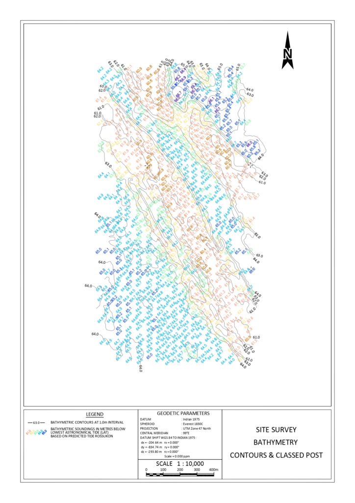
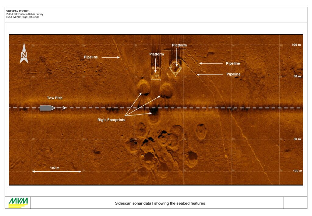
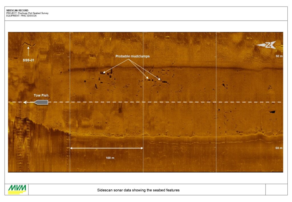
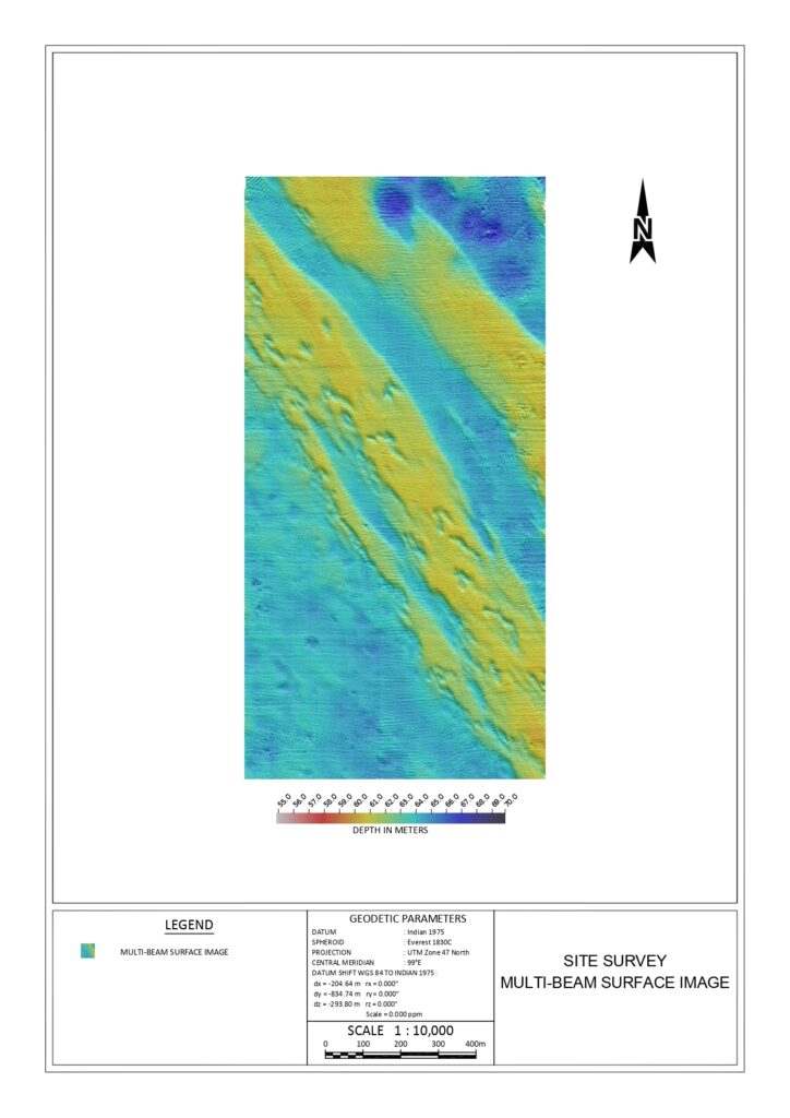
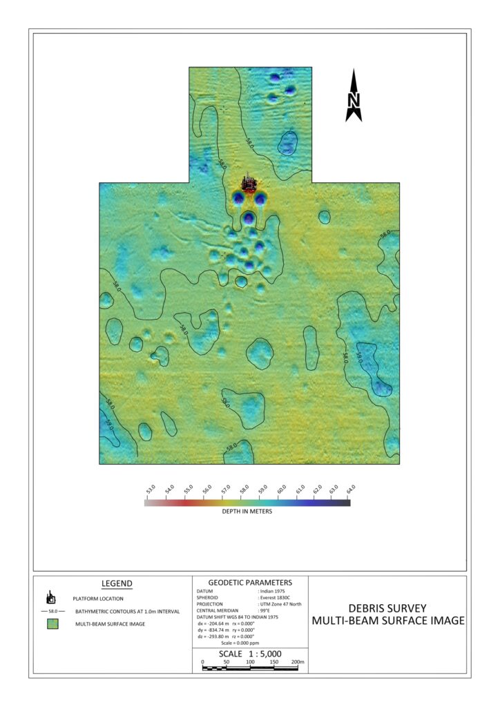
Geophysical Site Survey is an essential multidisciplinary operation conducted before offshore drilling, pipelaying, or platform installation.
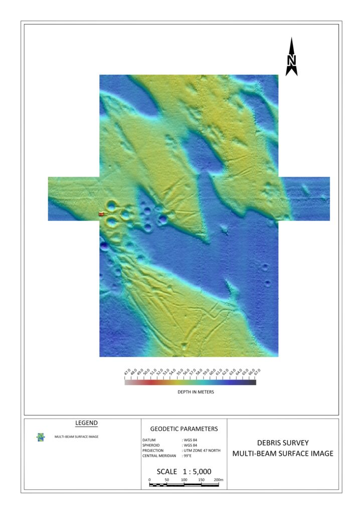
While a Debris Survey (for jack-up rigs) focuses primarily on the surface hazards, a full Geophysical Survey investigates the entire environment—extending from the water surface to several hundred meters below the seabed.
Surface Analysis
Detection of man-made debris, shipwrecks, and sea-floor obstructions.
Sub-Surface Insight
Mapping geological strata and identifying shallow gas hazards deep beneath the soil.
SSS_Platform
SSS_Pier
1. Objectives
- Geohazard Identification: Detecting shallow gas pockets, fault lines, or unstable "slump" areas that could cause a blowout or structural collapse. hat could cause a blowout or structural collapse.
- Engineering Design: Providing data for foundation engineering (e.g., how deep a pile should be driven or the slope stability for a pipeline).
- Infrastructure & Archaeological Mapping: Locating existing pipelines, cables, and shipwrecks to ensure safe clearance (typically 50m–500m).
- nfrastructure & Archaeological Mapping: Locating existing pipelines, cables, and shipwrecks to ensure safe clearance (typically 50m–500m).
- Benthic/Habitat Mapping: Identifying sensitive environmental areas (coral reefs, seagrass) to avoid ecological damage during installation
SBP_Multichanel
Well_MBES
Platform_MBES
2. Methodology & Equipment Functionality


Rig Positioning Service
A specialized navigation and surveying operation required to move a Mobile Offshore Drilling Unit (MODU) to a precise target location. The survey team acts as the "pilot" for the Tug Master and Rig OIM.
Core Objectives
Precision Targeting
To ensure the rig's "Rotary Table" or "Well Center" is positioned within a tight tolerance of the planned coordinates.
Collision Avoidance
To maintain safe clearance between the rig and existing infrastructure such as platforms, jackets, pipelines, or subsea wellheads.
Heading Control
To orient the rig in the correct direction (heading) to allow for prevailing winds/currents and ensure the drilling cantilever can reach intended well slots.
Final Verification
To provide an "As-Built" or "Final Location" report, confirming the exact geographical coordinates (Lat/Long and Eastings/Northings).
Anchor Management
For floating rigs, guiding Tugboats (AHTs) to drop anchors in specific patterns that avoid subsea pipelines and obstacles.
