Data Processing & Interpretation
MVM Survey reply on our in-house team of survey and geoscience professionals for data acquisition, processing, interpretation of data to enable the comprehensive presentation of final charts and report deliverables for all our projects. We pride ourselves on safe and efficient vessel data acquisition operations, comprehensive data processing and interpretation as well as the timely submission of final reports asn associated deliverables and ensure that they are an appropriate representation of the scope of work and our client’s ecpectations/requirements for the job.
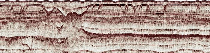
The following are examples of data acquisition and processing tools used:
- Sub-bottom Profiler Acquisition: GeoSuite
- Sub-bottom Profiler Data: GeoSuite and WinPICS
- Multibeam Acquisition/Navigation: PDS2000
- Multibeam Processing: PSD2000 and Caris Hips/Sips
- Single beam Navigation: Hypack
- Side Scan Sonar Data: EdgeTech Discover, SonarWiz and Caris Hips/Sips
- General Mapping: Surfer and AutoCad Map
MVM Survey reports have been developed through the completion of numerous projects and have been refined through an iterative process of client feedback and improvment techniques and technology. This allows us to give our clients exactly what is required based on the project requirements.